Geoimaging
Project Overview
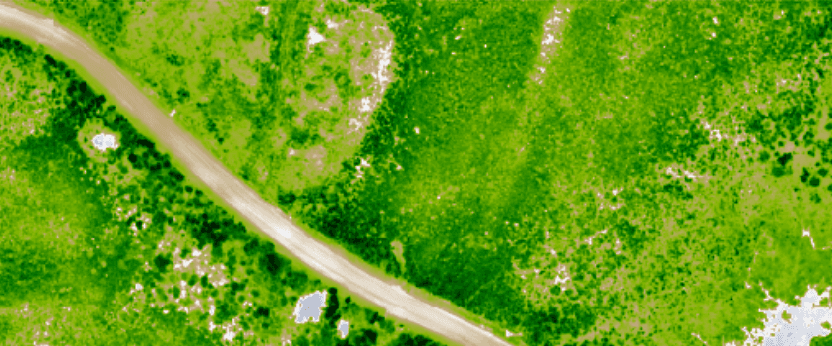
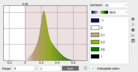
SAGD Development Area in northeast Alberta
A SAGD development requires a multiyear vegetation assessment to determine potential impacts. Working with vegetation specialists, Jeneric is providing data to use multi-spectral imaging in the determining potential impacts to the boreal forest and wetlands in the area.
Have a Similar Project?
We would love to learn about your project and discuss how we can help.
Start a Conversation