
Geomatics
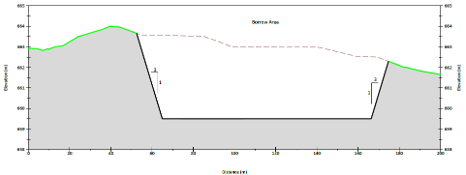
With Jeneric Consulting geomatics services, we provide our clients with drafting products that professionally present your data. Whether it’s a site diagram, cross-section, or a construction plan, Jeneric creates high quality products for your reports. We recognize that having figures and diagrams completed and available for use is key step in being able to interpret and report, so we pride ourselves in producing your figures in a timely manner. Jeneric can handle both GIS and AutoCAD data and uses the best product to meet your project needs.
Spatial Data and Mapping Solutions


Our GIS services provide the tools for spatial analysis, allowing clients to overlay and analyze various environmental datasets.
Environmental data combined with spatial attributes are managed and can be presented based on the needs of the report writer. Jeneric employs the ESRI suite of GIS software and provides timely and quality products to our clients.
Geographic Information Systems (GIS)

AutoCAD has been an industry standard design and drawing package for many years. Through the use of this software, Jeneric provides our clients with accurate and detailed drawings and figures, suitable for use by engineers and contractors.
AutoCad

Jeneric creates high quality and professional maps and figures. Our clients trust us with providing these products so they can get on with the interpretation and reporting of their projects to support their clients.
Mapping and Figures


Contact us with your project today!
